


Mensura

The standalone-engine solution that integrates with your CAD/BIM processes, for design studies and construction projects in urban development, linear infrastructure and underground networks.

Still weighing your options? Let’s talk
Talk to an expert to learn more about our solutions
Contact an expertMensura
The reference software solution for VRD (roads and utilities) design and infrastructure engineering.
The Mensura business software offers a complete production chain that begins with data acquisition: modelling of the existing site, 3D design of the project, through to production of your deliverables (plans, 3D models, estimates…), while meeting the requirements of BIM processes.
Mensura covers surveying, analysis of the initial terrain, excavation, calculation of underground and road infrastructure, production of plans and quotes, as well as 3D digital models. Design offices, land surveyors, local authorities, public works companies, network operators: Mensura covers the entire project life cycle, from design to construction.
Sogelink today claims 18,000 customers and 220,000 users worldwide.
A complete software solution
- Acquisition and processing of field data (surveying, point clouds)
- Modelling of natural terrain: DTM, contour lines, triangulation
- Analysis of existing conditions and integration of existing network data
- Import of base maps: DWG, DXF, IFC, orthophotos, land registry
- Linear projects: plan alignment, longitudinal profile, cross-sections
- Surface projects: platforms, earthworks, volume calculations
- Junctions and swept-path (turning) diagrams
- Horizontal road marking
- Setting-out and site calculations
- Quantity take-offs and DQE (Estimated Quantities Price Breakdown)
- Sewers and drainage: longitudinal profiles, hydraulic calculations
- Pressurised drinking water networks
- Dry networks (electricity, telecom, street lighting)
- Agricultural drainage
- Standalone graphics engine — no dependence on AutoCAD
- 3D design and production of digital models
- IFC (BIM) import/export
- 3D rendering
- 2D and 3D deliverables compliant with market standards
- Integrated BIM workflow: BCF import, attribute enrichment, BIM charters
- Integrated geotechnical studies
- 3D excavation: trench calculations, volume calculations
- BIM and 3D machine control
- Data sharing with surveying equipment and machine-guidance systems
- Standalone drawing engine with smart tools
- Fully customisable title blocks and layouts
- Optimised DWG export
- Compatible exchange formats: DWG, IFC, SHP, GIS data
The essential cloud platform for your CAD tool.
As the collaborative platform of the Sogelink ecosystem, Sogelink Connect centralises your projects in real time and makes sharing easier, breaking down the barriers between office and field.
Automatic loading of base maps (orthophotos, wetlands, vectorised cadastral parcels) into CAD tools, georeferenced or not.
Whether your project is already geolocated or still being scoped, automatically load the essential geographic data for your study area: orthophotos, vectorised cadastral parcels, wetlands or peatlands.
This data is available immediately in your working environment, with no re-entry or extra handling.
Available directly in Covadis, Uniplan automates the production of synthesis plans in response to DT-DICT. Rather than manually retracing existing networks, request a vectorised synthesis plan from Covadis: all the networks within your project footprint are consolidated and delivered ready to use in the solution, with no re-entry.
DICT2DAO helps you compile the plans received in response to DT-DICT. Apply processing and benefit from georeferencing assistance to make them easier to use in your business software.
Bring together your 2D plans, BIM models, network data and map base layers in a single interface. Query your data, take measurements and quickly access the information you need to better understand your project environment.
Create annotations on your files, assign tasks and share information with your teams. Track changes and simplify coordination between the project’s various stakeholders.
View your data from a smartphone or tablet, take synchronised notes and view your projects in augmented reality. Keep the office and the field connected and improve the monitoring of your sites.
Versions of Mensura
The new Mensura 2027 version speeds up your workflows, simplifies your exchanges and strengthens integration with the Sogelink Connect ecosystem, for a more modern and collaborative experience in the field and in the office.
-
Map import via Sogelink Connect
Mensura 2027 includes a new map import service connected to Sogelink Connect. Automatically load the essential data for a geographic area (orthophotos, vectorised cadastral parcels, wetlands, peatlands) to start your projects faster. Whether or not your project is already georeferenced, the data is retrieved in a few clicks.
-
Uniplan
Mensura now includes Uniplan to automate the use of DT-DICT responses. Heterogeneous network plans are consolidated into a single vectorised synthesis, directly usable in your studies. You reduce manual handling, make your data more reliable and speed up the preparation of your infrastructure projects.
-
Energy and Telecommunications module
Introduction of an automatic calculation of shared trenches. The module identifies footprints shared between several networks and consolidates volumes to make works estimation and quantity take-off preparation easier. This feature improves project accuracy from the design phase.
-
Redesigned DWG export
DWG export has been redesigned to offer more flexibility. You can now choose between visual fidelity of the rendering or preservation of styles to make editing easier in third-party CAD tools. This change improves compatibility with your workflows and simplifies the preparation of deliverables.
Why choose Mensura?
- 3 500 customers
- 18 000 users worldwide
- 35+ years of existence
-
Business objects
Carry out your studies quickly with the intelligence of business objects and avoid tedious or repetitive tasks. Every design object (road, network, platform…) is parametric and intelligent — it updates automatically when the project is modified.
-
Intuitive
Built on a standalone graphics engine, the tool is easy to pick up, with ergonomics adapted to the profession. It is quick to learn thanks to an interface designed for VRD engineers and technicians.
-
BIM workflow
Integrate BIM processes and produce 2D and 3D deliverables compliant with market standards. Mensura fits fully into your BIM chain: IFC import, attribute enrichment, BCF exchanges, deliverables compliant with project owners’ BIM charters.
-
A solution that speaks your profession
Mensura is not just a technical drawing tool. For the uses where it really makes a difference — platforms, earthworks, basins — it builds your experience and business logic directly into an interface designed to stay intuitive at every step.
-
A standalone, sovereign engine
Mensura runs on a standalone graphics platform, independent of AutoCAD, developed and maintained in France and Europe. You keep total control of your production tool, with no dependence on a third-party publisher.
-
A highly praised 3D viewer
View and share your projects directly in 3D, with no export or additional tool. One of the features rated highest by our users, which makes exchanges easier during both the study and client approval phases.
The full Sogelink ecosystem around Mensura
-
 Find out more
 Sogelink Connect
The cloud platform that interconnects your business solutions
- Contractor
- Design and Engineering Office
- Network operator
- Public authority
- Surveyor | Topographer
-
 Find out more
 Uniplan
The turnkey network synthesis plan to speed up and secure your projects.
- Contractor
- Design and Engineering Office
- Public authority
- Surveyor | Topographer
-
 Find out more
 DICT.fr by Sogelink
The platform that makes your work near utility networks safer, from the initial declaration to the opening of the site
- Contractor
- Design and Engineering Office
- Public authority
- Surveyor | Topographer
-
 Find out more
 Land2Map
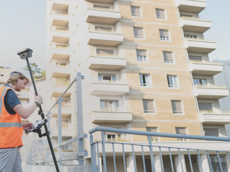
Touchscreen tablet surveying software that works natively in DWG format
- Contractor
- Design and Engineering Office
- Public authority
- Surveyor | Topographer
-
 Find out more
 Geosnap
Sogelink’s photogrammetry solution covering the entire chain — from field acquisition (mobile via the Geosnap Mobile app, action camera such as GoPro/DJI, or drone) to cloud processing — for your topographic survey sites
- Contractor
- Design and Engineering Office
- Public authority
- Surveyor | Topographer
Would you like a demo or a quote?
Our experts are available to answer all your questions.